
Aerial imagery technology is currently only used by a minority of winegrape growers in Australia as a part of their vineyard operations.
Oli Madgett writes that this lack of adoption is a shame as the field has seen massive improvements in recent years.
The resolution of imagery from space is now less than one metre, and allied with significant reductions in cost, Australia-wide coverage and increases in the frequency of imagery captures in the growing season (presently as low as $10/ha for a minimum of four captures a year), the technology represents a very powerful digital tool that could be in the hands of any grower this season.
We’ve spent the past three months driving and ‘Zooming’ all around Langhorne Creek, McLaren Vale and the Adelaide Hills to get a real feel for all the ways that vineyards and winemakers are finding imagery practically useful. We want to share these stories to help other growers see value that imagery can provide.
There are the six broad ways that the wine industry is making use of imagery that we want to highlight; and there are some current barriers to adoption we’ve noticed, too, so a few initial recommendations on how we can collaboratively overcome those, as well.
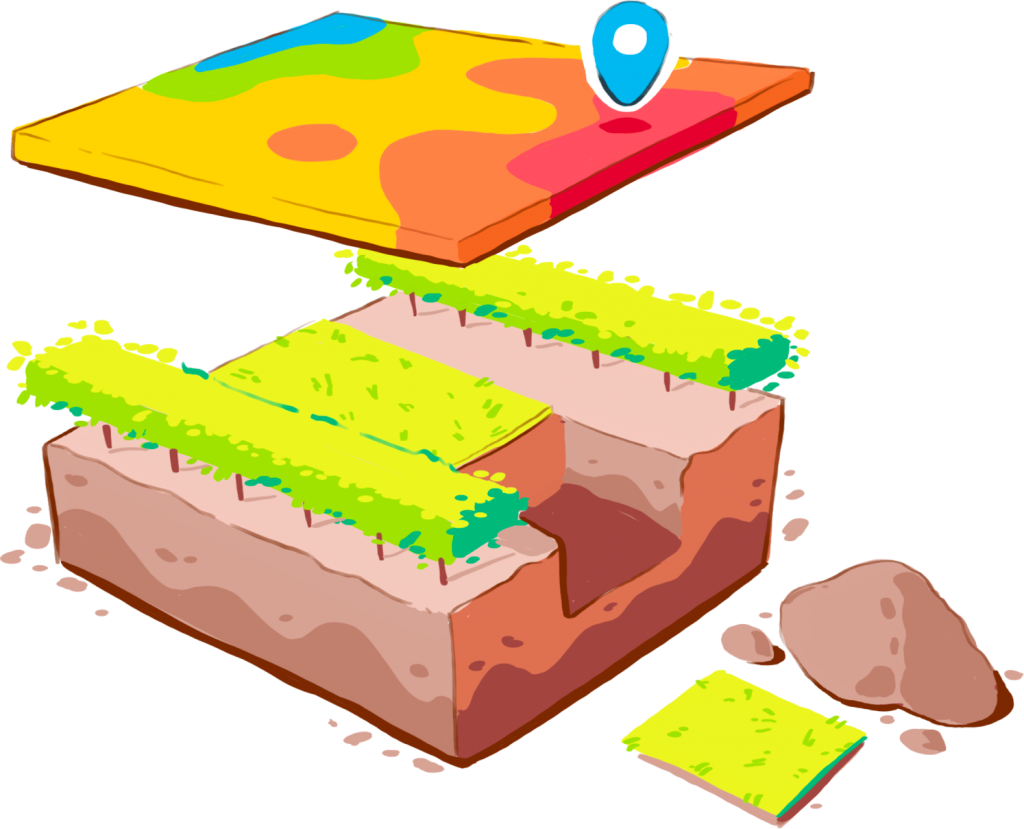
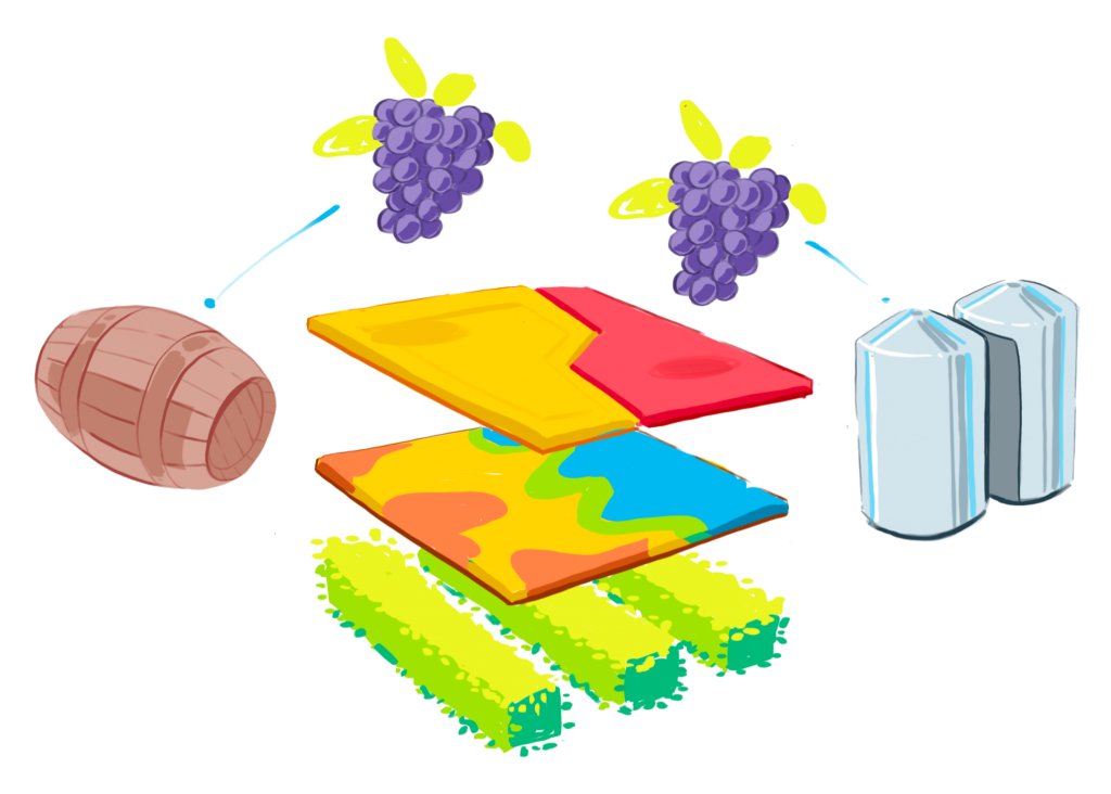
Imagery can be used to identify a vineyard’s average areas. This facilitates the placement of soil moisture sensors, and assists when taking soil or plant tissue samples for testing.
For example, with George Dridan at Integrated Precision Viticulture, who told us: “In terms of the optimal placement of soil moisture sensors, I use aerial vigour imagery to locate the most representative zone of the vineyard, and install them there so that growers are irrigating to the majority of their block”.
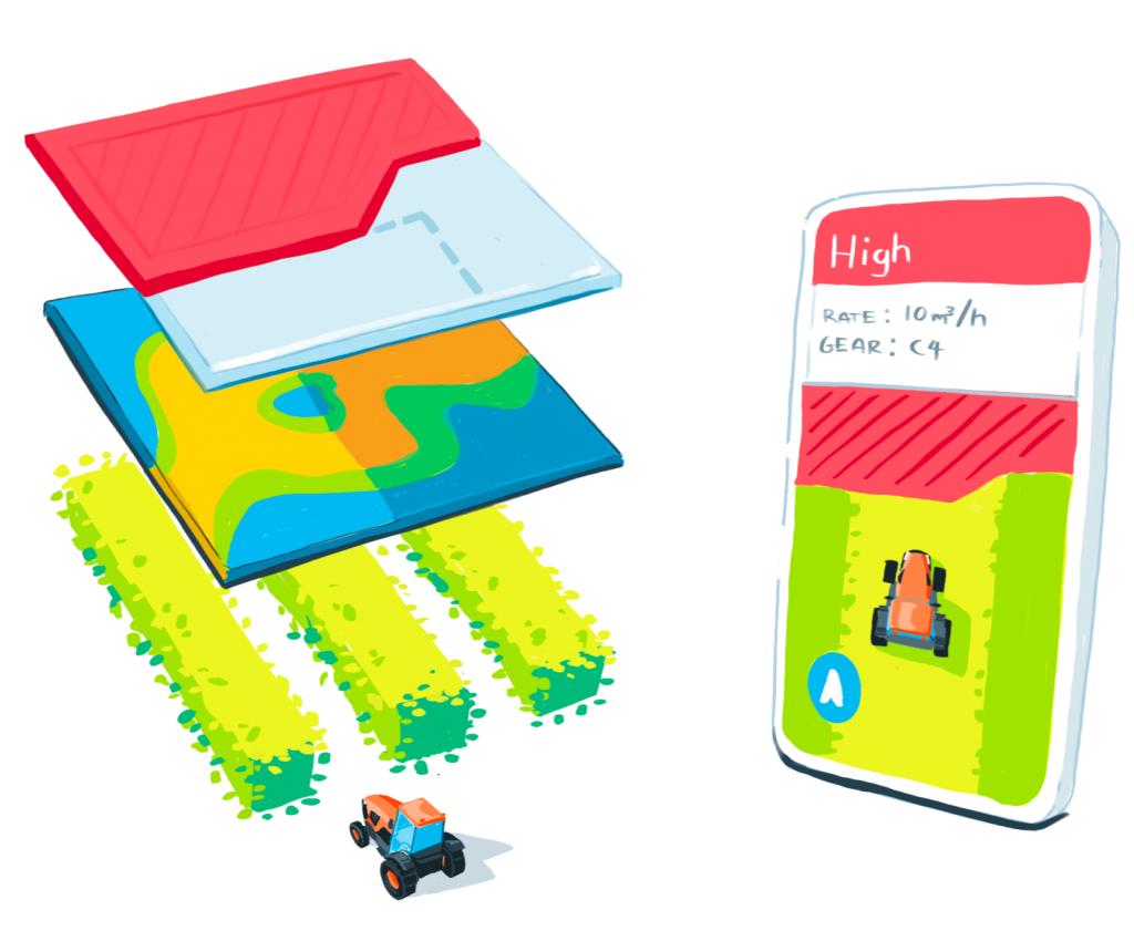
Imagery can be used to highlight areas of significant variability. Growers are using tools such as Platfarm to create prescription maps showing where on their blocks remediation work needs to be done. Once out in the block, Platfarm acts like a sat nav, telling the user when to start and stop work, or change rate – making targeted mulching, strategic ripping, and variable rate spreading much less of a hassle.
“At Taylors Wines, we’ve had high resolution aerial vigour imagery taken by V3Maps during veraison for over 10 years, which we store in PCT Agcloud. For the past two winters we’ve pulled the imagery into Platfarm and used it to direct the targeted application of Dura Mulch, which has enabled us to significantly extend the number of blocks that we can cover within our mulching budget,” explained Peter Rogge, Taylors Wines’ viticulture manager.
Imagery can be used to identify the areas of vineyards that are really struggling. Digging soil pits in these zones, along with targeted soil testing, allows growers to get a better understanding of what the limiting factors are, so they can create effective management plans.
Matt Wilson, viticultural consultant at DJ’S Growers has been doing just this.
“Rather than growers ‘throwing darts in the dark’ when it comes to trying to rectify problem areas within vineyards, we use satellite NDVI imagery, with Paul Roberts in Langhorne Creek, to identify where differing zones are. We then dig soil pits and target chemical and physical soil analysis on those locations, in order to get to the bullseye of the issue”.
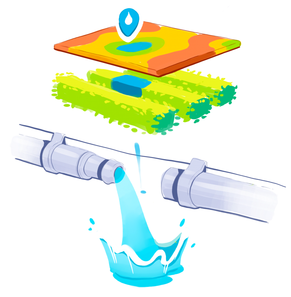
Imagery can be used to highlight irrigation issues. Whether it’s blue patches that may indicate leaks, or areas of low vigour which can point towards design problems such as low flow rates, finding problems is the first step towards solving them.
“We could clearly see where we were suffering from irrigation design problems, with insufficient flow getting to the end of certain rows – we’ve been able to focus on these issues over the winter and improve overall water use efficiency,” said Jenny Venus, senior viticulturist at Brad Case Contracting.
As imagery capture becomes more frequent, with turn-around times often below 48 hours, growers like CMV Farms and Angove Family Winemakers have been able to use crop stress and thermal imagery to inform their in-season decision making, such as irrigation scheduling.
“We’ve had Ceres Imaging flying over our vineyards throughout the growing season, and their crop stress imagery helps us to make timely and valuable decisions and corrections to our irrigation scheduling,” revealed Angove Family Winemakers’ viticulture manager, Nick Bakkum.
Imagery can be used to identify areas of the vineyard to target wines for vintage. Viticulture managers, such as Bakkum at Angove, are using change detection software at key times between captures in their Grade A blocks to make corrections in the vineyard to get a better harvest result.
Ben Pridham at Pridham Viticulture in McLaren Vale is also at the forefront of using imagery with his clients like Nick Bourke, the winemaker at Hugh Hamilton Wines.
“During vintage,” explained Pridham, “we shared images with Nick, so that he could easily see the vigour differences in blocks, giving him the option to harvest A Grade sections at the optimum time.”
The 15-20% of innovators and early adopters who are already using imagery aren’t looking back: they’ve found genuine utility and value in the technology. It is relatively new technology coming into an established industry, though, so the current challenge is achieving more mainstream adoption.
When we talk to growers, there are some recurring themes related to the challenges they face and the objections they raise. They’re worth discussing.
I don’t understand what it’s showing?
Last time I just ended up printing off the imagery and sticking it on the office wall
All this digital stuff is all just too hard work to be worth it…
I don’t think I’ll see a return on investment
I don’t know who to choose at this stage